
Clear Creek Group Campground
Its sites are reservable through Recreation.gov, camping costs Group Site: $108 per night (1-30 people), $182 per night (31-80 people), and it is open year-round. Clear Creek Group Campground is a National Forest campground near Camp Verde, Arizona.
Reservable: Recreation.gov
 1 / 4
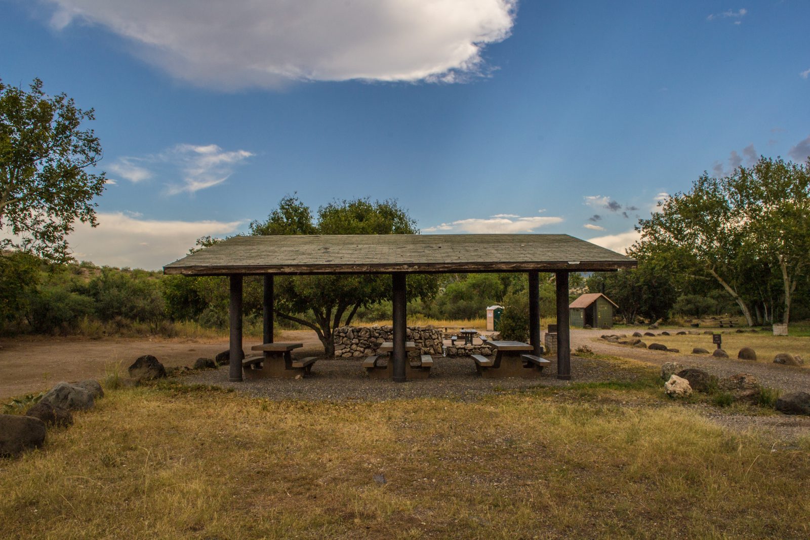
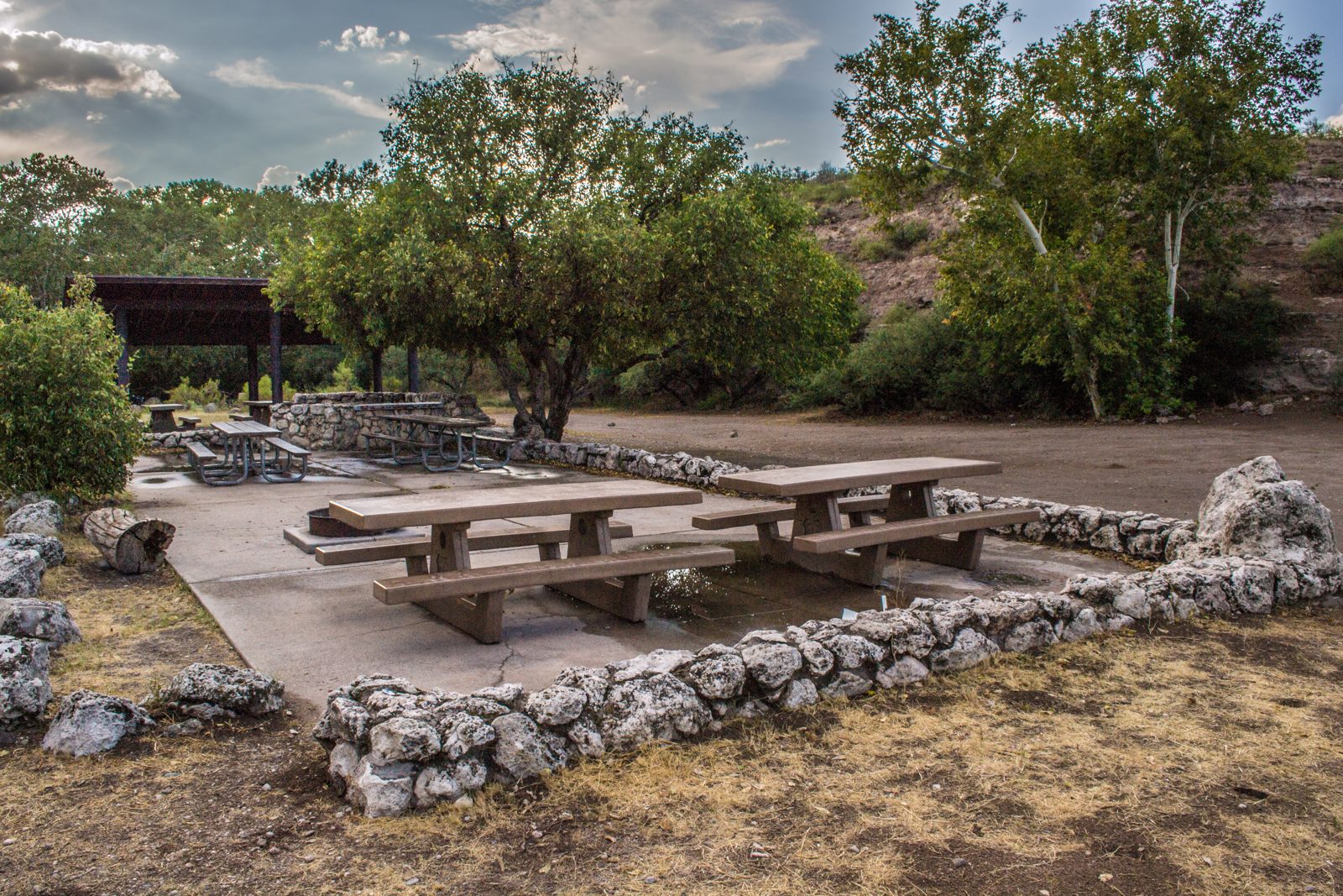
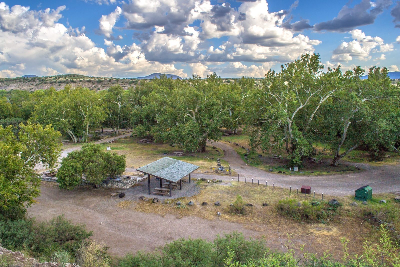
1 / 4A large picnic shelter at the Clear Creek campgrounds. Photo: USDA Forest Service, Coconino National Forest, Public domain (US federal government work, 17 U.S.C. 105)
- Managed by
- National Forest
- Max RV length
- 32 ft
- Access road
- Gravel
Clear Creek Group Campground sits inside Coconino National Forest. Its dispersed-camping rule, ranger offices, and boundary are on publiclandsdb.com.
West Clear Creek: West Clear Creek runs along the campground boundary and is popular for hiking, swimming, wading and fishing for smallmouth bass and green sunfish. (fs.usda.gov)
Getting a site
- Managed by
- National Forest
- Reservations
- Recreation.gov
- Fee
- Group Site: $108 per night (1-30 people), $182 per night (31-80 people)
Sources: apps.fs.usda.gov, accessed 2026-09-28; fs.usda.gov, accessed 2026-09-29
Sites and hookups
- Group sites
- 1
- Group site capacity
- Up to 80 people
- Max RV length
- 32 ft
- ✓ Toilets
- ✓ Potable water
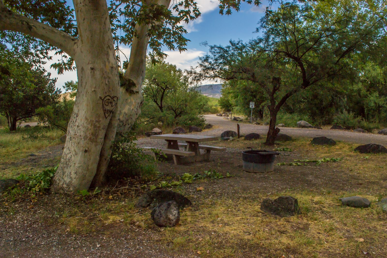
- ✓ Fire rings
- ✓ Pets allowed
On site: Toilets, potable water, fire rings, and pets allowed.
Sources: apps.fs.usda.gov, accessed 2026-09-28; fs.usda.gov, accessed 2026-09-29
Rules
- Stay limit
- 7 days
- Quiet hours
- 10 p.m. to 6 a.m.
- Generators
- Allowed outside quiet hours
- Pets
- Allowed
- Campground host
- On site
Sources: apps.fs.usda.gov, accessed 2026-09-28; fs.usda.gov, accessed 2026-09-29
Access and cell service
- Access road
- Gravel
- Elevation
- 3,236 ft
Cell coverage by carrier (FCC map)
- AT&T
- 4G LTE
- T-Mobile
- 4G LTE; 5G mapped about 0.3 mi away
- Verizon
- 4G LTE; 5G mapped about 0.4 mi away
Source: FCC Broadband Data Collection, data as of December 31, 2025
Outdoor coverage each carrier reports to the FCC at this campground's map point, and the nearest mapped coverage within about half a mile. The FCC map only includes 4G LTE at 5/1 Mbps or better and 5G; a weaker signal, a text, or an emergency call may still get through, but don't count on it. These are carrier predictions, not measurements, and can be wrong either way: real service in canyons, under trees, and inside a tent or vehicle is often weaker. 5G speeds are the FCC's 7/1 and 35/3 Mbps tiers. This product uses the FCC Data API but is not endorsed or certified by the FCC.
34.5167, -111.7678 in Yavapai. Open in OpenStreetMap. Map © OpenStreetMap contributors.
Season and winter services
Clear Creek Group Campground is open year-round .
Sources: apps.fs.usda.gov, accessed 2026-09-28; fs.usda.gov, accessed 2026-09-29
Common questions
Do you need a reservation at Clear Creek Group Campground?
How much does it cost to camp at Clear Creek Group Campground?
How many campsites does Clear Creek Group Campground have?
Is there drinking water at Clear Creek Group Campground?
Are dogs allowed at Clear Creek Group Campground?
When is Clear Creek Group Campground open?
How long can you stay at Clear Creek Group Campground?
Are generators allowed at Clear Creek Group Campground?
Is there cell service at Clear Creek Group Campground?
Is there a campground host at Clear Creek Group Campground?
Who manages Clear Creek Group Campground?
Around Clear Creek Group Campground
Public land within 15 miles: West Clear Creek Wilderness (6.2 miles to its center) , Cedar Bench Wilderness (9.8 miles to its center) , Wet Beaver Wilderness (13 miles to its center) , and Fossil Springs Wilderness (15 miles to its center) ; publiclandsdb.com has each unit's camping rules and boundary.
Hot springs, waterfalls and swimming nearby
Nearest to Clear Creek Group Campground, in straight-line miles: Fossil Creek (swimming hole, 11 miles), Verde Hot Springs (hot spring, 12 miles), Fossil Creek Waterfall (waterfall, 12 miles), The Crack (swimming hole, 13 miles), and Crescent Moon (swimming hole, 21 miles). Each has its own page on swimholesmap.com.
More campgrounds: camping near Camp Verde and campgrounds in Yavapai.
Sources
- apps.fs.usda.gov (all fields), accessed 2026-09-28
- fs.usda.gov (all fields), accessed 2026-09-29
- broadbandmap.fcc.gov (cellCoverage), accessed 2026-09-27
Photo credits
- Photo 1: USDA Forest Service, Coconino National Forest, Public domain (US federal government work, 17 U.S.C. 105)
- Photo 2: USDA Forest Service, Coconino National Forest, Public domain (US federal government work, 17 U.S.C. 105)
- Photo 3: USDA Forest Service, Coconino National Forest, Public domain (US federal government work, 17 U.S.C. 105)
- Photo 4: USDA Forest Service, Coconino National Forest, Public domain (US federal government work, 17 U.S.C. 105)