
Camping near Silver Springs, Nevada
Camping near Silver Springs, Nevada includes 2 public campgrounds on record, 2 reservable. All are run by the state park system. The nearest, Lahontan State Recreation Area, is 0.8 miles from Silver Springs in a straight line, and all 2 are within 15 miles. 2 stay open all year. Another 1 public campground filed under nearby towns is within 30 miles of Silver Springs.
noindex Fewer than 5 campgrounds here clear the indexable bar yet, so this page stays noindex.
Camping near Silver Springs at a glance
- Public campgrounds
- 2 (2 State Park)
- Getting a site
- 2 reservable
- Cost
- Lowest posted fee at Fort Churchill State Historic Park: "$15/night ($20 non-NV)"
- Distance from Silver Springs
- 0.8 miles (Lahontan State Recreation Area) to 6.8 miles (Fort Churchill State Historic Park) in a straight line; 2 within 15 miles
- Elevation
- 4,157 ft (Lahontan State Recreation Area) to 4,250 ft (Fort Churchill State Historic Park), 2 of 2 on record
- Season
- 2 open all year
- Campsites
- 20 across the 1 campground that state a count
- RVs
- 1 take RVs; no hookups on record; longest stated RV length 50 ft (Lahontan State Recreation Area)
- Drinking water
- 2 of 2
Distances are straight-line miles from Silver Springs's point in the US Census Bureau Gazetteer (2025), not driving distances. Every other fact comes from each campground's own sourced record, linked from its page.
More campgrounds within 30 miles of Silver Springs
- Dayton State Park, 22 miles from Silver Springs in a straight line , State Park , reservable ($15/night ($20 non-NV)); listed under camping near Dayton.
Things to do near Silver Springs
Public land and water within 30 miles of Silver Springs, the public land its campgrounds sit in, and landmarks at those campgrounds, nearest first.
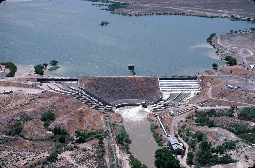
- Lahontan Dam, at Lahontan State Recreation Area (0.8 miles from Silver Springs): A Newlands Project dam on the Carson River completed in 1915, 162 feet high and 1,700 feet long.
- Lahontan Reservoir (Silver Springs), a swimming hole whose mapped point is 0.8 miles from Silver Springs; swimming details on swimholesmap.com.
- Lahontan State Recreation Area, its campground is 0.8 miles from Silver Springs; publiclandsdb.com has its hours, entrance fee, and boundary.
- Silver Springs Boat Launch, a boat launch whose mapped point is 0.8 miles from Silver Springs; launch details on boatrampsfinder.com.
- Lahontan Reservoir fishing, a fishing water whose mapped point is 2.6 miles from Silver Springs; stocking record and species on fishypedia.com.
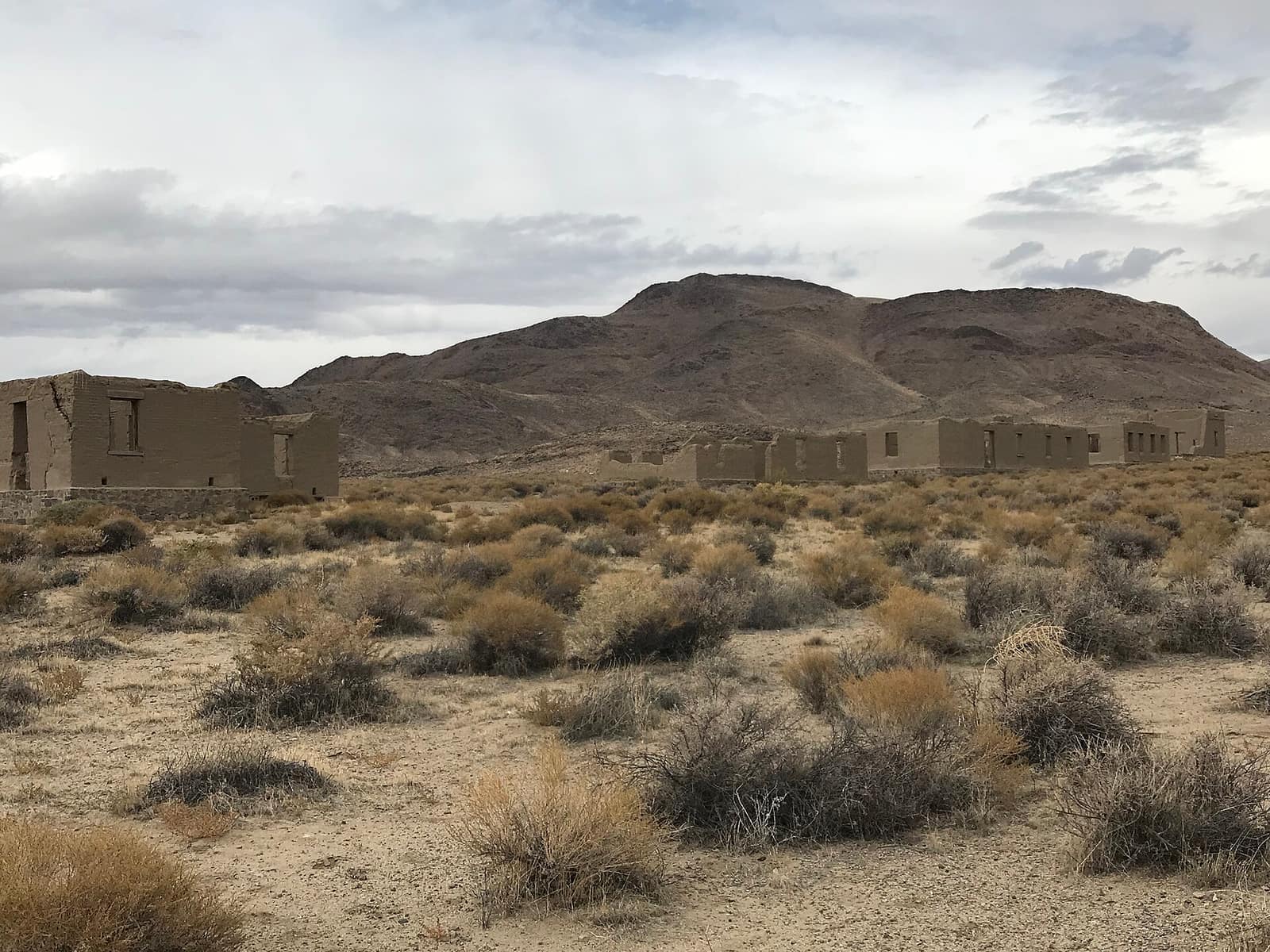
- Fort Churchill ruins, at Fort Churchill State Historic Park (6.8 miles from Silver Springs): A U.S. Army post built in 1860 and abandoned in 1869, preserved in a state of arrested decay near the campground.
- Fort Churchill State Historic Park, its campground is 6.8 miles from Silver Springs; publiclandsdb.com has its hours, entrance fee, and boundary.
- Lahontan Reservoir water level, a reservoir whose mapped point is 9.6 miles from Silver Springs; current water level on reservoirfinder.com.
- Fort Churchill Cooling Pond fishing, a fishing water whose mapped point is 19 miles from Silver Springs; stocking record and species on fishypedia.com.
- North Pond fishing, a fishing water whose mapped point is 19 miles from Silver Springs; stocking record and species on fishypedia.com.
Supplies and emergencies near Silver Springs
Nearest emergency room: Banner Churchill Community Hospital, 801 E Williams Ave, Fallon, NV, 25 miles from Silver Springs , (775) 423-3151. Next nearest: South Lyon Medical Center, 213 S Whitacre St, Yerington, NV, 28 miles, (775) 781-3761. Both report emergency services in the CMS Hospital General Information dataset (accessed 2026-09-26) . In an emergency, call 911.
- Groceries
-
- Silver Crossing
- Spring Market
- Stagecoach Market
- Fuel
-
- Chevron
- Spring Market Gas
- 7-11
- RV dump station
-
- Virginia City RV Park
- Pharmacy
-
- Silver Stage Pharmacy
- Walgreens
- Laundromat
-
- Fresh and Clean
Not mapped in OpenStreetMap within 25 miles of Silver Springs: propane, potable water fill, and ice. Stores, fuel, propane, dump stations, water fill, laundromats, and pharmacies are the nearest few mapped within 25 miles, straight-line, © OpenStreetMap contributors (data as of 2026-09-26; this extract under the ODbL). Hours are as mapped; call ahead.
Common questions
Where can I camp around Silver Springs, NV?
Is there free camping near Silver Springs, NV?
Where can I camp with an RV near Silver Springs, NV?
Where can I camp near Silver Springs with drinking water?
Are there year-round campgrounds near Silver Springs, NV?
Where can I camp near a lake around Silver Springs, NV?
Where is the nearest emergency room to Silver Springs, NV?
Every campground in the state: camping in Nevada ; by agency: State Park campgrounds in Nevada ; by county: campgrounds in Lyon .