
Camping near John Day, Oregon
Camping near John Day, Oregon includes 4 public campgrounds on record, 2 reservable and 2 first-come. The U.S. Forest Service runs the most, 2 of 4. The nearest, Grant County RV Park, is 0.3 miles from John Day in a straight line, and all 4 are within 15 miles. Another 21 public campgrounds filed under nearby towns are within 30 miles of John Day.

noindex Fewer than 5 campgrounds here clear the indexable bar yet, so this page stays noindex.
Camping near John Day at a glance
- Public campgrounds
- 4 (2 National Forest, 1 County, 1 State Park)
- Getting a site
- 2 reservable and 2 first-come
- Cost
- Lowest posted fee at Starr: "Single Site: $6 per night; additional vehicle $3 per night"
- Distance from John Day
- 0.3 miles (Grant County RV Park) to 15 miles (Wickiup) in a straight line; 4 within 15 miles
- Elevation
- 2,877 ft (Clyde Holliday State Recreation Site) to 5,100 ft (Starr), 4 of 4 on record
- Season
- 1 seasonal with posted dates
- Campsites
- 31 across the 1 campground that state a count
- RVs
- 2 take RVs; hookups at Grant County RV Park and Clyde Holliday State Recreation Site
- Drinking water
- 2 of 4
Distances are straight-line miles from John Day's point in the US Census Bureau Gazetteer (2025), not driving distances. Every other fact comes from each campground's own sourced record, linked from its page.
- Agency
- County
- Sites
- Not on record
- Season
- Not on record
- Fee
- $45/night full hookup (incl. room tax); tent $10/night in the Orchard Area; showers $5
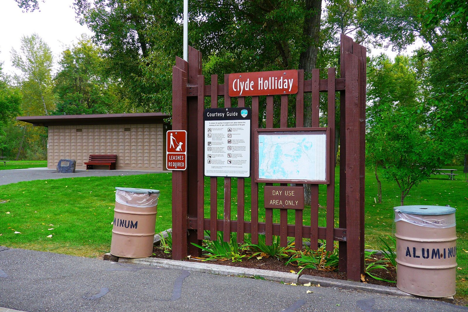 Reservable Clyde Holliday State Recreation Site
 - Agency
- State Park
- Sites
- 31
- Season
- March 1 to November 30
- Fee
- Residents: electric $29-$55 a night (2026 statewide ranges)
- Agency
- National Forest
- Sites
- Not on record
- Season
- Not on record
- Fee
- Single Site: $6 per night; additional vehicle $3 per night
- Agency
- National Forest
- Sites
- Not on record
- Season
- Not on record
- Fee
- Single Site: $6 per night; additional vehicle $3 per night
More campgrounds within 30 miles of John Day
- Magone Lake Recreation Area, 9.3 miles from John Day in a straight line , National Forest , reservable (Single Site: $13 per night); listed under camping near Prairie City.
- Raddue Forest Camp, 12 miles from John Day in a straight line , National Forest , first-come (free); listed under camping near Mount Vernon.
- Strawberry, 16 miles from John Day in a straight line , National Forest , first-come (Single Site: $8 per night; additional vehicle $4 per night); listed under camping near Prairie City.
- Slide Creek, 16 miles from John Day in a straight line , National Forest , first-come (free); listed under camping near Prairie City.
- Mcnaughton Spring, 16 miles from John Day in a straight line , National Forest , first-come (free); listed under camping near Prairie City.
- Billy Fields, 18 miles from John Day in a straight line , National Forest , first-come (free); listed under camping near Dayville.
- Parish Cabin, 19 miles from John Day in a straight line , National Forest , first-come (Single Site: $8 per night; additional vehicle $4); listed under camping near Seneca.
- Lower Camp Creek, 19 miles from John Day in a straight line , National Forest , first-come (Single Site: $6 per night; additional vehicle $3); listed under camping near Prairie City.
- Oregon Mine, 20 miles from John Day in a straight line , National Forest , first-come (free); listed under camping near Mt Vernon.
- Dixie, 20 miles from John Day in a straight line , National Forest , first-come (Single Site: $8 per night); listed under camping near Prairie City.
- Murray, 21 miles from John Day in a straight line , National Forest , first-come (Single Site: $8 per night; additional vehicle $4); listed under camping near Prairie City.
- Trout Farm, 21 miles from John Day in a straight line , National Forest , first-come (Single Site: $8 per night; additional vehicle $4 per night); listed under camping near Prairie City.
- Crescent, 22 miles from John Day in a straight line , National Forest , first-come (free); listed under camping near Prairie City.
- Middle Fork, 23 miles from John Day in a straight line , National Forest , reservable (Single Site: $8 per night); listed under camping near Austin Junction.
- Big Creek, 23 miles from John Day in a straight line , National Forest , reservable (Single Site: $8 per night); listed under camping near Seneca.
- Deerhorn Forest Camp, 23 miles from John Day in a straight line , National Forest , first-come (Single Site: $8 per night); listed under camping near Austin Junction.
- Bates State Park, 25 miles from John Day in a straight line , State Park , first-come ; listed under camping near Greenhorn.
- Head O' Boulder Forest Camp, 27 miles from John Day in a straight line , National Forest , first-come (free); listed under camping near Austin Junction.
- Rock Springs, 29 miles from John Day in a straight line , National Forest , first-come (Single Site: $6 per night; additional vehicle $3); listed under camping near Burns.
- Elk Flat Spring, 29 miles from John Day in a straight line , National Forest , first-come (free); listed under camping near Unity.
- Elk Creek, 30 miles from John Day in a straight line , National Forest , first-come (free); listed under camping near Prairie City.
Things to do near John Day
Public land and water within 30 miles of John Day, the public land its campgrounds sit in, and landmarks at those campgrounds, nearest first.
- John Day River walk, at Grant County RV Park (0.3 miles from John Day): Beside the John Day River and the Grant County Fairgrounds, with a river walk trail updated in 2011; shade trees and groomed lawns.
- Logan Valley, at Starr (11 miles from John Day): A few miles past the campground on US 395, Logan Valley is known for spring, summer and fall wildflowers and wildlife viewing; trailheads into the Strawberry Mountain Wilderness are within a 7-mile drive.
- Malheur National Forest, 2 of the 4 campgrounds here sit inside this national forest, the nearest Starr at 11 miles from John Day; publiclandsdb.com has its dispersed-camping rule, ranger offices, and boundary.
- Strawberry Mountain Wilderness, a wilderness area whose mapped point is 13 miles from John Day; its permit and camping rules and boundary on publiclandsdb.com.
- Canyon Creek, at Wickiup (15 miles from John Day): The campground sits among trees next to Canyon Creek off Forest Road 15, with stream fishing; horses may not be pastured on Wickiup Creek or kept inside the campground.
- Bates State Park, a state park whose mapped point is 25 miles from John Day; its hours, entrance fee, and boundary on publiclandsdb.com.
Supplies and emergencies near John Day
Nearest emergency room: Blue Mountain Hospital, 170 Ford Rd, John Day, OR, 0.1 miles from John Day , (541) 575-1311. Next nearest: Harney District Hospital, 557 W Washington St, Burns, OR, 58 miles, (541) 573-7281. Both report emergency services in the CMS Hospital General Information dataset (accessed 2026-09-26) . In an emergency, call 911.
- Groceries
-
- Chester's
- Bare Bones - The Outback Smoke Shop
- FastBreak
- Fuel
-
- Leather's Fuels
- FastBreak
- RV dump station
-
- Clyde Holliday Campground
- Pharmacy
-
- Len's Drug
- Prairie Drug
Not mapped in OpenStreetMap within 25 miles of John Day: propane, potable water fill, laundromat, and ice. Stores, fuel, propane, dump stations, water fill, laundromats, and pharmacies are the nearest few mapped within 25 miles, straight-line, © OpenStreetMap contributors (data as of 2026-09-29; this extract under the ODbL). Hours are as mapped; call ahead.
Common questions
Where can I camp around John Day, OR?
Is there free camping near John Day, OR?
Where can I camp with an RV near John Day, OR?
Where can I camp near John Day with drinking water?
Where is the nearest emergency room to John Day, OR?
Every campground in the state: camping in Oregon ; by agency: County campgrounds in Oregon , National Forest campgrounds in Oregon and State Park campgrounds in Oregon ; by county: campgrounds in Grant .