
Camping near Johnson, Arkansas
Camping near Johnson, Arkansas includes 2 public campgrounds on record, 2 reservable. All are run by the U.S. Army Corps of Engineers. The nearest, Spadra, is 63 miles from Johnson in a straight line, and none is within 15 miles. Another 12 public campgrounds filed under nearby towns are within 30 miles of Johnson.
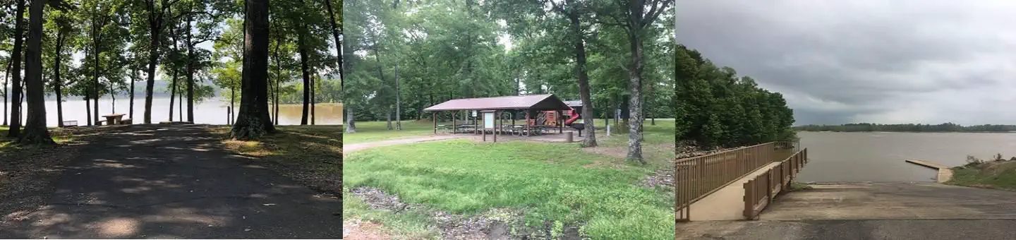
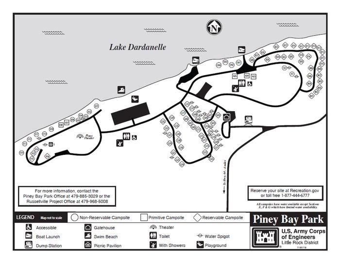
noindex Fewer than 5 campgrounds here clear the indexable bar yet, so this page stays noindex.
Camping near Johnson at a glance
- Public campgrounds
- 2 (2 Army Corps of Engineers)
- Getting a site
- 2 reservable
- Distance from Johnson
- 63 miles (Spadra) to 70 miles (Piney Bay) in a straight line; none within 15 miles
- Elevation
- 354 ft (Spadra) to 354 ft (Piney Bay), 2 of 2 on record
- Campsites
- 114 across the 2 campgrounds that state a count
- RVs
- 2 take RVs; hookups at Spadra and Piney Bay; longest stated RV length 80 ft (Piney Bay)
Distances are straight-line miles from Johnson's point in the US Census Bureau Gazetteer (2025), not driving distances. Every other fact comes from each campground's own sourced record, linked from its page.
More campgrounds within 30 miles of Johnson
- War Eagle Campground, 11 miles from Johnson in a straight line , Army Corps of Engineers , reservable ; listed under camping near Washington.
- Hickory Creek Park, 11 miles from Johnson in a straight line , Army Corps of Engineers , reservable ; listed under camping near Benton.
- Lake Wedington Recreation Area, 12 miles from Johnson in a straight line , National Forest , reservable (Single Site: $20 per night, cabins $80-$140 night); listed under camping near Fayetteville.
- Horseshoe Bend, 14 miles from Johnson in a straight line , Army Corps of Engineers , reservable ; listed under camping near Benton.
- Prairie Creek, 17 miles from Johnson in a straight line , Army Corps of Engineers , reservable ; listed under camping near Benton.
- Rocky Branch Campground, 19 miles from Johnson in a straight line , Army Corps of Engineers , reservable ; listed under camping near Benton.
- Lost Bridge South, 24 miles from Johnson in a straight line , Army Corps of Engineers , reservable ; listed under camping near Benton.
- Starkey Campground, 24 miles from Johnson in a straight line , Army Corps of Engineers , reservable ; listed under camping near Carroll.
- Lost Bridge North, 25 miles from Johnson in a straight line , Army Corps of Engineers , reservable ; listed under camping near Benton.
- Indian Creek Campground, 25 miles from Johnson in a straight line , Army Corps of Engineers , reservable ; listed under camping near Benton.
- Dam Site Lake Campground, 27 miles from Johnson in a straight line , Army Corps of Engineers , reservable ; listed under camping near Carroll.
- Dam Site River, 27 miles from Johnson in a straight line , Army Corps of Engineers , reservable ; listed under camping near Carroll.
Things to do near Johnson
Public land and water within 30 miles of Johnson, the public land its campgrounds sit in, and landmarks at those campgrounds, nearest first.
- Prairie Grove Battlefield State Park, a state park whose mapped point is 12 miles from Johnson; its hours, entrance fee, and boundary on publiclandsdb.com.
- Logan Cave National Wildlife Refuge, a national wildlife refuge whose mapped point is 13 miles from Johnson; its hours, camping, hunting and fishing rules, and boundary on publiclandsdb.com.
- Hobbs State Park – Conservation Area, a state park whose mapped point is 17 miles from Johnson; its hours, entrance fee, and boundary on publiclandsdb.com.
- Pea Ridge National Military Park, a National Park Service unit whose mapped point is 23 miles from Johnson; its entrance fees, current alerts and fire restrictions, and boundary on publiclandsdb.com.
- Devil's Den State Park, a state park whose mapped point is 25 miles from Johnson; its hours, entrance fee, and boundary on publiclandsdb.com.
- Withrow Springs State Park, a state park whose mapped point is 25 miles from Johnson; its hours, entrance fee, and boundary on publiclandsdb.com.
- Natural Falls, a waterfall whose mapped point is 28 miles from Johnson; details on the falls on swimholesmap.com.
- Natural Falls State Park, a state park whose mapped point is 28 miles from Johnson; its hours, entrance fee, and boundary on publiclandsdb.com.
Supplies and emergencies near Johnson
Nearest emergency room
Washington Regional Medical Center
3215 N Northhills Blvd, Fayetteville, AR, 2.1 miles from Johnson . (479) 463-5113
Next nearest: Arkansas Children's Northwest, Inc, 2601 S Gene George Blvd, Springdale, AR, 2.3 miles , (479) 725-6800.
In an emergency, call 911.
Both report emergency services in the CMS Hospital General Information dataset (accessed 2026-09-26) .
- Groceries
-
- E-Z Mart
- Casey's General Store
- Walmart Supercenter
- Fuel
-
- E-Z Mart
- Walmart
- Casey's General Store
- Propane
-
- AmeriGas
- AmeriGas
- Pharmacy
-
- Collier Drug Stores
- Walgreens
- Heartland Pharmacy
- Laundromat
-
- Kamp Laundry
- Hawg Wash Laundry
- Sit & Spin
Not mapped in OpenStreetMap within 25 miles of Johnson: RV dump station, potable water fill, and ice. Stores, fuel, propane, dump stations, water fill, laundromats, and pharmacies are the nearest few mapped within 25 miles, straight-line, © OpenStreetMap contributors (data as of 2026-10-01; this extract under the ODbL). Hours are as mapped; call ahead.
Common questions
Where can I camp around Johnson, AR?
2 public campgrounds are on record near Johnson. Nearest first, straight-line from town: Spadra (63 miles) and Piney Bay (70 miles). 2 book through Recreation.gov.
Where can I camp with an RV near Johnson, AR?
2 campgrounds near Johnson take RVs: Piney Bay and Spadra. Piney Bay and Spadra have hookups.
Where is the nearest emergency room to Johnson, AR?
Washington Regional Medical Center, 3215 N Northhills Blvd, Fayetteville, AR, is 2.1 miles from Johnson in a straight line and reports emergency services to CMS; phone (479) 463-5113. In an emergency, call 911.
Every campground in the state: camping in Arkansas ; by agency: Army Corps of Engineers campgrounds in Arkansas .