
Camping near Lone Pine, California
Camping near Lone Pine, California includes 6 public campgrounds on record, 1 reservable and 5 first-come. All are run by the U.S. Forest Service. The nearest, Whitney Portal Campground, is 8.4 miles from Lone Pine in a straight line, and all 6 are within 15 miles. Another 5 public campgrounds filed under nearby towns are within 30 miles of Lone Pine.
noindex Fewer than 5 campgrounds here clear the indexable bar yet, so this page stays noindex.
Camping near Lone Pine at a glance
- Public campgrounds
- 6 (6 National Forest)
- Getting a site
- 1 reservable and 5 first-come
- Cost
- Lowest posted fee at Cottonwood Lakes Walk in Campground: "Single Site: $11 per night"
- Distance from Lone Pine
- 8.4 miles (Whitney Portal Campground) to 10 miles (Cottonwood Pass Walk in Campground) in a straight line; 6 within 15 miles
- Elevation
- 7,920 ft (Whitney Portal Campground) to 10,018 ft (Cottonwood Lakes Walk in Campground), 6 of 6 on record
- Campsites
- 46 across the 1 campground that state a count
- RVs
- 1 take RVs; no hookups on record; longest stated RV length 35 ft (Whitney Portal Campground)
- Drinking water
- 5 of 6
Distances are straight-line miles from Lone Pine's point in the US Census Bureau Gazetteer (2025), not driving distances. Every other fact comes from each campground's own sourced record, linked from its page.
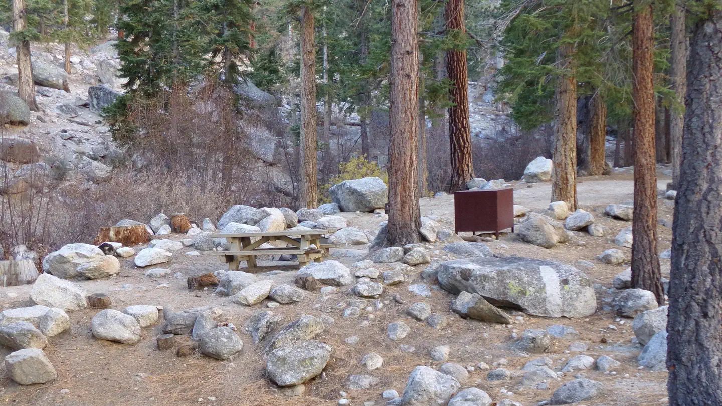 Whitney Portal Campground
 - Sites
- 46
- Season
- Not on record
- Fee
- Single Site: $34 per night

- Sites
- Not on record
- Season
- Not on record
- Fee
- Overnight Use:
- Sites
- Not on record
- Season
- Not on record
- Fee
- Overnight Use:
- Sites
- Not on record
- Season
- Not on record
- Fee
- Single Site: $24 per night
- Sites
- Not on record
- Season
- Not on record
- Fee
- Single Site: $11 per night
- Sites
- Not on record
- Season
- Not on record
- Fee
- Single Site: $22 per night
No campgrounds match these filters.
More campgrounds within 30 miles of Lone Pine
- Tuttle Creek Campground, 2.7 miles from Lone Pine in a straight line , BLM , reservable (Site: $10 per night); listed under camping near Inyo.
- Lone Pine Campground, 6 miles from Lone Pine in a straight line , National Forest , reservable (Single Site: $34 per night); listed under camping near Inyo.
- Grays Meadows, 18 miles from Lone Pine in a straight line , National Forest , reservable ; listed under camping near Inyo.
- Grays Meadow Campground, 18 miles from Lone Pine in a straight line , National Forest , first-come (Single Site: $34 per night); listed under camping near Independence.
- Onion Valley Campground, 20 miles from Lone Pine in a straight line , National Forest , reservable (Single Site: $31 per night); listed under camping near Independence.
Things to do near Lone Pine
Public land and water within 30 miles of Lone Pine, the public land its campgrounds sit in, and landmarks at those campgrounds, nearest first.
- Diaz Lake fishing, a fishing water whose mapped point is 1.7 miles from Lone Pine; stocking record and species on fishypedia.com.
- Lone Pine Creek fishing, a fishing water whose mapped point is 1.8 miles from Lone Pine; stocking record and species on fishypedia.com.
- Tuttle Creek fishing, a fishing water whose mapped point is 2.6 miles from Lone Pine; stocking record and species on fishypedia.com.
- Alabama Hills National Scenic Area, a BLM unit whose mapped point is 4.4 miles from Lone Pine; its camping rule, field office, and boundary on publiclandsdb.com.
- Georges Creek fishing, a fishing water whose mapped point is 9.3 miles from Lone Pine; stocking record and species on fishypedia.com.
- Manzanar National Historic Site, a National Park Service unit whose mapped point is 11 miles from Lone Pine; its entrance fees, current alerts and fire restrictions, and boundary on publiclandsdb.com.
- Inyo Mountains Wilderness, a wilderness area whose mapped point is 12 miles from Lone Pine; its permit and camping rules and boundary on publiclandsdb.com.
- Malpais Mesa Wilderness, a wilderness area whose mapped point is 20 miles from Lone Pine; its permit and camping rules and boundary on publiclandsdb.com.
- Saline Valley Hot Springs, a hot spring whose mapped point is 23 miles from Lone Pine; soaking details on swimholesmap.com.
- Sequoia-Kings Canyon Wilderness, a wilderness area whose mapped point is 26 miles from Lone Pine; its permit and camping rules and boundary on publiclandsdb.com.
Supplies and emergencies near Lone Pine
Nearest emergency room
Southern Inyo Hospital
501 E Locust St, Lone Pine, CA, 2.7 miles from Lone Pine . (760) 876-5501
Next nearest: Northern Inyo Hospital, 150 Pioneer Ln, Bishop, CA, 57 miles , (760) 873-5811.
In an emergency, call 911.
Both report emergency services in the CMS Hospital General Information dataset (accessed 2026-09-26) .
- Groceries
-
- Lee's Frontier General Store
- Lone Pine Market
- Summit
- Fuel
-
- Chevron
- Mobil
- Shell
- RV dump station
-
- Lone Pine Mobile Oasis
- Laundromat
-
- Lone Pine Laundromat
Not mapped in OpenStreetMap within 25 miles of Lone Pine: propane, potable water fill, pharmacy, and ice. Stores, fuel, propane, dump stations, water fill, laundromats, and pharmacies are the nearest few mapped within 25 miles, straight-line, © OpenStreetMap contributors (data as of 2026-10-01; this extract under the ODbL). Hours are as mapped; call ahead.
Common questions
Where can I camp around Lone Pine, CA?
6 public campgrounds are on record near Lone Pine. Nearest first, straight-line from town: Whitney Portal Campground (8.4 miles), Lone Pine Group Campground (8.5 miles), Whitney Portal Group Campground (8.5 miles), Whitney Trailhead Walk in Campground (8.8 miles), and 2 more. 5 are first-come, first-served with no reservations and 1 books through Recreation.gov.
Is there free camping near Lone Pine, CA?
Not at a developed campground: each of the 6 public campgrounds on record near Lone Pine charges a fee, listed in the table.
Where can I camp with an RV near Lone Pine, CA?
1 campground near Lone Pine takes RVs: Whitney Portal Campground. None has hookups on record. The nearest mapped RV dump station is at Lone Pine Mobile Oasis, 2.7 miles from town (OpenStreetMap).
Where can I go tent camping near Lone Pine, CA?
Whitney Portal Campground lists tent or walk-in sites on record.
Where can I camp near Lone Pine with drinking water?
Cottonwood Lakes Walk in Campground, Cottonwood Pass Walk in Campground, Whitney Portal Campground, Whitney Portal Group Campground, and 1 more have potable water on record.
Where is the nearest emergency room to Lone Pine, CA?
Southern Inyo Hospital, 501 E Locust St, Lone Pine, CA, is 2.7 miles from Lone Pine in a straight line and reports emergency services to CMS; phone (760) 876-5501. In an emergency, call 911.
Every campground in the state: camping in California ; by agency: National Forest campgrounds in California .