
Camping near Quincy, California
Camping near Quincy, California includes 11 public campgrounds on record, 9 reservable and 2 first-come. All are run by the U.S. Forest Service. The nearest, Spanish Creek Group (group), is 6.7 miles from Quincy in a straight line, and 8 of 11 are within 15 miles. Another 70 public campgrounds filed under nearby towns are within 30 miles of Quincy.
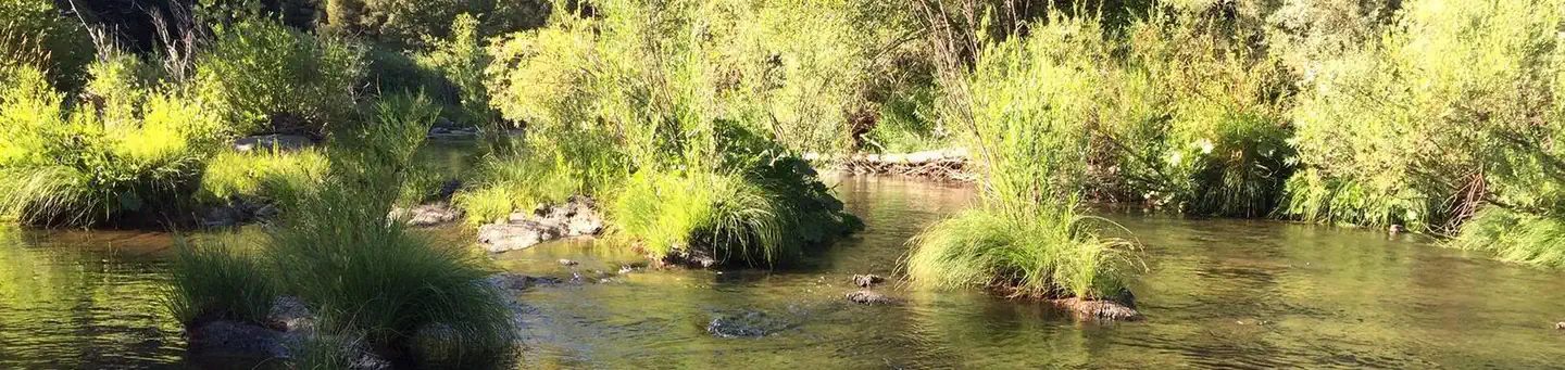 Spanish Creek (family Campground)
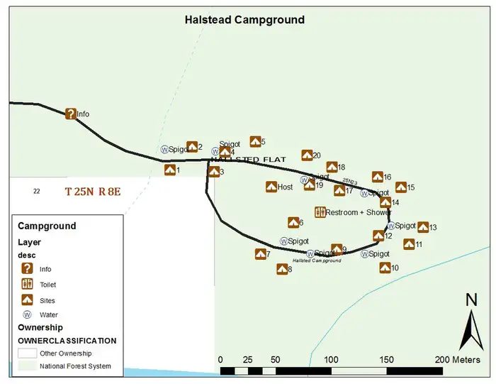 Hallsted (family Campground)
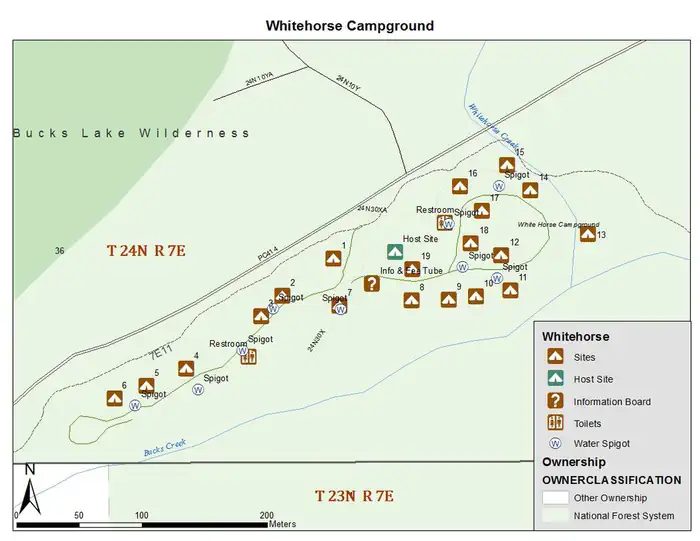 Whitehorse (family Campground)
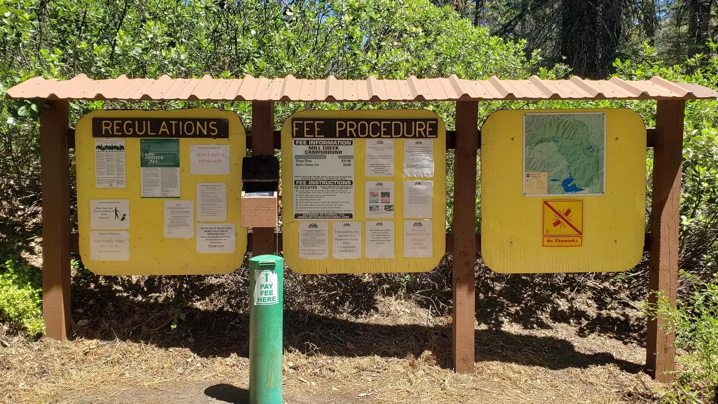 Mill Creek (family Campground)
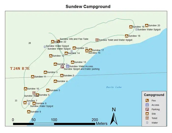 Sundew (family Campground)
Camping near Quincy at a glance
- Public campgrounds
- 11 (11 National Forest)
- Getting a site
- 9 reservable and 2 first-come
- Cost
- Lowest posted fee at Grizzly Creek (family Campground): "Single Site: $26 per night"
- Distance from Quincy
- 6.7 miles (Spanish Creek Group (group)) to 16 miles (Queen Lily (family Campground)) in a straight line; 8 within 15 miles
- Elevation
- 2,312 ft (Gansner Bar (family Campground)) to 5,240 ft (Mill Creek (family Campground)), 11 of 11 on record
- Campsites
- 155 across the 9 campgrounds that state a count
- RVs
- 3 take RVs; hookups at Hallsted (family Campground); longest stated RV length 99 ft (Spanish Creek (family Campground))
- Drinking water
- 10 of 11
Distances are straight-line miles from Quincy's point in the US Census Bureau Gazetteer (2025), not driving distances. Every other fact comes from each campground's own sourced record, linked from its page.

- Sites
- Not on record
- Season
- Not on record
- Fee
- Overnight Use:
Spanish Creek (family Campground) - Sites
- 27
- Season
- Not on record
- Fee
- Single Site: $35 per night
Hallsted (family Campground) - Sites
- 20
- Season
- Not on record
- Fee
- Single Site (Non-Electric): $35 per night
Whitehorse (family Campground) - Sites
- 19
- Season
- Not on record
- Fee
- Single Site: $38 per night
Mill Creek (family Campground) - Sites
- 10
- Season
- Not on record
- Fee
- Single Site: $31 per night
Sundew (family Campground) - Sites
- 21
- Season
- Not on record
- Fee
- Single Site: $32 per night
- Sites
- Not on record
- Season
- Not on record
- Fee
- Overnight Use:
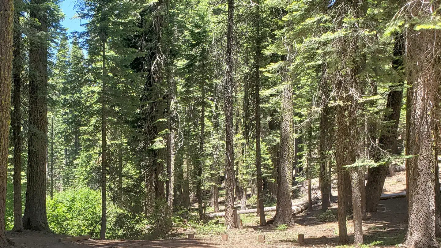 Grizzly Creek (family Campground)
 - Sites
- 11
- Season
- Not on record
- Fee
- Single Site: $26 per night
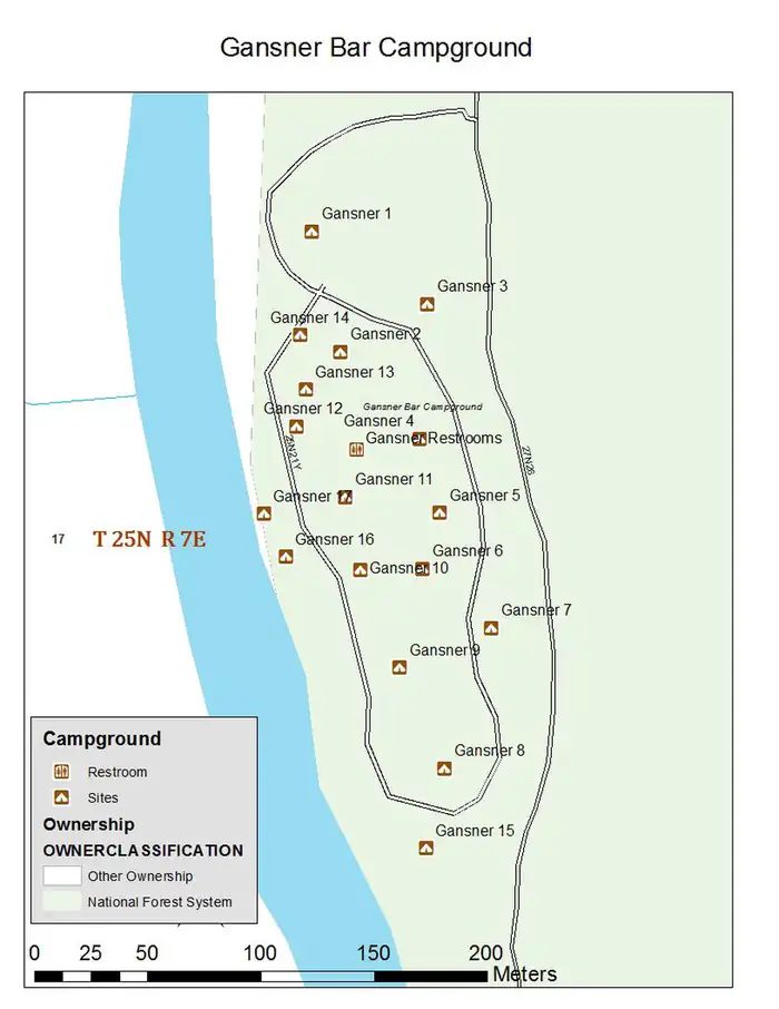 Gansner Bar (family Campground)
 - Sites
- 14
- Season
- Not on record
- Fee
- Single Site: $31 per night
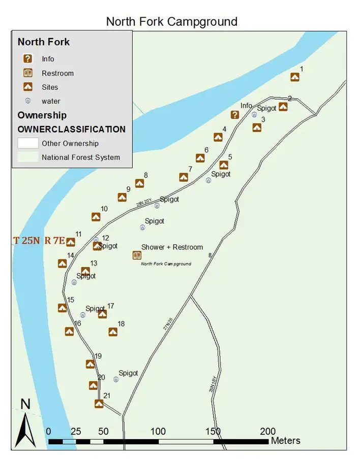 North Fork (family Campground)
 - Sites
- 21
- Season
- Not on record
- Fee
- Single Site (Non-Electric): $35 per night
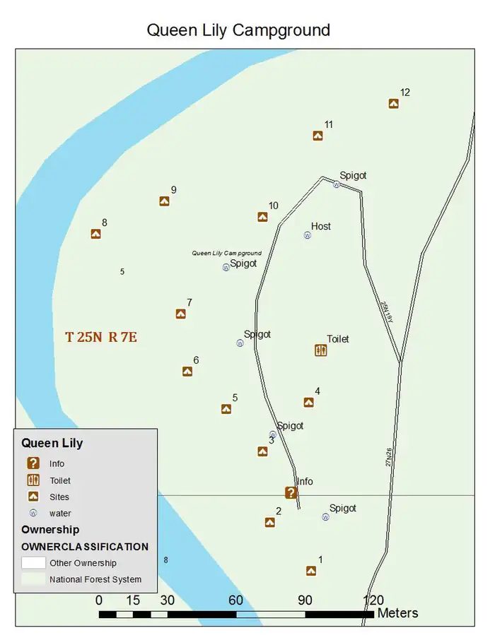 Queen Lily (family Campground)
 - Sites
- 12
- Season
- Not on record
- Fee
- Single Site: $31 per night
No campgrounds match these filters.
More campgrounds within 30 miles of Quincy
- Rock Creek (family Campground), 4.2 miles from Quincy in a straight line , National Forest , first-come (Single Site: $15 per night); listed under camping near Plumas.
- Snake Lake (family Campground), 4.4 miles from Quincy in a straight line , National Forest , first-come (Single Site: $15 per night); listed under camping near Plumas.
- Meadow Camp, 4.6 miles from Quincy in a straight line , National Forest , reservable ; listed under camping near Plumas.
- Deanes Valley (family Campground), 4.7 miles from Quincy in a straight line , National Forest , first-come (Single Site: $15 per night); listed under camping near Meadow Valley.
- Red Bridge, 7.6 miles from Quincy in a straight line , National Forest , first-come (free); listed under camping near Plumas.
- Silver Lake (family Campground), 9.6 miles from Quincy in a straight line , National Forest , reservable (Site: $20 per night); listed under camping near Plumas.
- Rock Creek Campground, 9.8 miles from Quincy in a straight line , National Forest , reservable (Site: $15 per night); listed under camping near Plumas.
- Bradys Camp (family Campground), 11 miles from Quincy in a straight line , National Forest , first-come (free); listed under camping near Plumas.
- Stag Point Ohv Trailhead and Camp, 12 miles from Quincy in a straight line , National Forest , first-come (free); listed under camping near Plumas.
- Little Beaver a Campground, 13 miles from Quincy in a straight line , National Forest , reservable ; listed under camping near Plumas.
- Wyandotte a Campground, 13 miles from Quincy in a straight line , National Forest , reservable ; listed under camping near Plumas.
- Running Deer (family Campground), 13 miles from Quincy in a straight line , National Forest , reservable (Single Site: $23 per night); listed under camping near Plumas.
- Hutchins, 13 miles from Quincy in a straight line , National Forest , reservable ; listed under camping near Plumas.
- Horse Campground, 14 miles from Quincy in a straight line , National Forest , reservable ; listed under camping near Plumas.
- Red Feather California, 14 miles from Quincy in a straight line , National Forest , reservable ; listed under camping near Plumas.
- Lower Bucks (family Campground), 14 miles from Quincy in a straight line , National Forest , first-come ; listed under camping near Plumas.
- Red Feather (family Campground), 14 miles from Quincy in a straight line , National Forest , first-come (Single Site: $36 per night); listed under camping near LaPorte.
- Little Beaver (family Campground), 14 miles from Quincy in a straight line , National Forest , first-come (Single Site: $23 per night); listed under camping near LaPorte.
- Black Rock Tent(family Campground), 14 miles from Quincy in a straight line , National Forest , first-come (Single Site: $23 per night); listed under camping near LaPorte.
- Wyandotte (family Campground), 14 miles from Quincy in a straight line , National Forest , first-come (Single Site: $23 per night); listed under camping near LaPorte.
- Tooms Rv Camp, 15 miles from Quincy in a straight line , National Forest , first-come (Single Site: $23 per night); listed under camping near LaPorte.
- Peninsula Tent (family Campground), 15 miles from Quincy in a straight line , National Forest , first-come (Single Site: $23 per night); listed under camping near LaPorte.
- Greenville (family Campground), 16 miles from Quincy in a straight line , National Forest , reservable (Single Site: $25 per night); listed under camping near Greenville.
- Poker Flat Ohv Camp, 17 miles from Quincy in a straight line , National Forest , first-come (free); listed under camping near Sierra.
- Grizzly Forebay (family Campground), 18 miles from Quincy in a straight line , National Forest , first-come (free); listed under camping near Plumas.
- Little North Fork (family Campground), 19 miles from Quincy in a straight line , National Forest , first-come (free); listed under camping near Plumas.
- Rocky Point, 20 miles from Quincy in a straight line , National Forest , first-come (free); listed under camping near Plumas.
- American House Ohv Camp, 21 miles from Quincy in a straight line , National Forest , first-come (free); listed under camping near Yuba.
- Rogers Cow Camp (family Campground), 22 miles from Quincy in a straight line , National Forest , first-come ; listed under camping near Butte.
- Lakes Basin Group Campground., 22 miles from Quincy in a straight line , National Forest , first-come (Overnight Use:); listed under camping near Graeagle.
- Lakes Basin Family Campground., 22 miles from Quincy in a straight line , National Forest , first-come (Single Site: $36 per night); listed under camping near Graeagle.
- Milsap Bar (family Campground), 23 miles from Quincy in a straight line , National Forest , first-come ; listed under camping near Butte.
- Almanor, 23 miles from Quincy in a straight line , National Forest , reservable (Single Site: $18 per night); listed under camping near Plumas.
- Almanor Legacy Campground, 23 miles from Quincy in a straight line , National Forest , first-come (Single Site: $30 per night); listed under camping near Plumas.
- Almanor Group, 23 miles from Quincy in a straight line , National Forest , first-come (Overnight Use:); listed under camping near Plumas.
- Legacy Campground, 23 miles from Quincy in a straight line , National Forest ; listed under camping near Plumas.
- Lightning Tree, 24 miles from Quincy in a straight line , National Forest , reservable ; listed under camping near Plumas.
- Gold Lake 4x4 Campground, 24 miles from Quincy in a straight line , National Forest , first-come (free); listed under camping near Graeagle.
- Gold Lake Campground, 24 miles from Quincy in a straight line , National Forest , reservable (Single Site: $25 per night); listed under camping near Graeagle.
- Lightning Tree Family Campground., 24 miles from Quincy in a straight line , National Forest , first-come (Single Site: $38 per night.); listed under camping near Portola.
- Lakes Basin, 24 miles from Quincy in a straight line , National Forest , reservable ; listed under camping near Sierra.
- Goose Lake Campground, 24 miles from Quincy in a straight line , National Forest , first-come (Single Site: $25 per night); listed under camping near Graeagle.
- Golden Trout Crossing, 25 miles from Quincy in a straight line , National Forest , first-come (Single Site: $15 per night); listed under camping near Butte.
- Strawberry, 25 miles from Quincy in a straight line , National Forest , first-come ; listed under camping near Butte.
- Haven Lake Campground, 25 miles from Quincy in a straight line , National Forest , first-come (Single Site: $25 per night); listed under camping near Graeagle.
- Snag Lake, 25 miles from Quincy in a straight line , National Forest , first-come (free); listed under camping near Sierra City.
- Sly Creek, 25 miles from Quincy in a straight line , National Forest , first-come ; listed under camping near Butte.
- Boulder Creek (family Campground), 26 miles from Quincy in a straight line , National Forest , reservable (Single Site: $36 per night); listed under camping near Taylorsville.
- Grasshopper Flat Family Campground., 26 miles from Quincy in a straight line , National Forest , first-come (Single Site: $38 per night); listed under camping near Portola.
- Lone Rock (family Campground), 26 miles from Quincy in a straight line , National Forest , reservable (Single Site: $36 per night); listed under camping near Taylorsville.
- Grizzly Family Campground., 26 miles from Quincy in a straight line , National Forest , first-come (Single Site: $38 per night); listed under camping near Portola.
- Soldier Meadows, 26 miles from Quincy in a straight line , National Forest , first-come (Single Site: $10 per night); listed under camping near Plumas.
- Long Point (family Campground), 26 miles from Quincy in a straight line , National Forest , reservable (Single Site: $36 per night); listed under camping near Taylorsville.
- Long Point (group Campground), 27 miles from Quincy in a straight line , National Forest , first-come (Overnight Use:); listed under camping near Taylorsville.
- Berger Creek, 27 miles from Quincy in a straight line , National Forest , first-come (Single Site: $20 per night); listed under camping near Sierra City.
- Diablo, 27 miles from Quincy in a straight line , National Forest , reservable (Single Site: $20 per night); listed under camping near Sierra City.
- Packsaddle, 27 miles from Quincy in a straight line , National Forest , reservable (Single Site: $24 per night); listed under camping near Sierra City.
- Ramshorn, 27 miles from Quincy in a straight line , National Forest , reservable (Single Site: $24 per night); listed under camping near Dorrington.
- Union Flat, 27 miles from Quincy in a straight line , National Forest , reservable (Single Site: $24 per night); listed under camping near Dorrington.
- Philbrook, 28 miles from Quincy in a straight line , National Forest , first-come (free); listed under camping near Butte.
- Salmon Creek, 28 miles from Quincy in a straight line , National Forest , reservable (Single Site: $24 per night); listed under camping near Sierra City.
- Sardine, 28 miles from Quincy in a straight line , National Forest , first-come (Single Site: $24 per night); listed under camping near Sierra City.
- Crocker Family Campground., 28 miles from Quincy in a straight line , National Forest , first-come (Single Site: $15 per night); listed under camping near Portola.
- Cal Ida, 29 miles from Quincy in a straight line , National Forest , reservable (Single Site: $24 per night); listed under camping near Camptonville.
- Carlton, 29 miles from Quincy in a straight line , National Forest , reservable (Single Site: $24 per night); listed under camping near Camptonville.
- Fiddle Creek, 29 miles from Quincy in a straight line , National Forest , reservable (Single Site: $24 per night); listed under camping near Camptonville.
- Indian Valley, 29 miles from Quincy in a straight line , National Forest , reservable (Single Site: $24 per night); listed under camping near Sierra.
- Rocky Rest, 29 miles from Quincy in a straight line , National Forest , reservable (Single Site: $24 per night); listed under camping near Camptonville.
- Loganville, 30 miles from Quincy in a straight line , National Forest , reservable (Single Site: $24 per night); listed under camping near Sierra City.
- Sierra, 30 miles from Quincy in a straight line , National Forest , reservable (Single Site: $20 per night); listed under camping near Sierra City.
Things to do near Quincy
Public land and water within 30 miles of Quincy, the public land its campgrounds sit in, and landmarks at those campgrounds, nearest first.
- Spanish Creek fishing, a fishing water whose mapped point is 4.4 miles from Quincy; stocking record and species on fishypedia.com.
- Round Valley Reservoir fishing, a fishing water whose mapped point is 12 miles from Quincy; stocking record and species on fishypedia.com.
- Bucks Lake fishing, a fishing water whose mapped point is 13 miles from Quincy; stocking record and species on fishypedia.com.
- Bucks Lake Wilderness, a wilderness area whose mapped point is 14 miles from Quincy; its permit and camping rules and boundary on publiclandsdb.com.
- Little Grass Valley Reservoir fishing, a fishing water whose mapped point is 14 miles from Quincy; stocking record and species on fishypedia.com.
- Plumas-Eureka State Park, a state park whose mapped point is 18 miles from Quincy; its hours, entrance fee, and boundary on publiclandsdb.com.
- Graeagle Mill Pond fishing, a fishing water whose mapped point is 21 miles from Quincy; stocking record and species on fishypedia.com.
- Lake Almanor fishing, a fishing water whose mapped point is 23 miles from Quincy; stocking record and species on fishypedia.com.
- Mountain Meadows Reservoir fishing, a fishing water whose mapped point is 23 miles from Quincy; stocking record and species on fishypedia.com.
- Gold Lake fishing, a fishing water whose mapped point is 24 miles from Quincy; stocking record and species on fishypedia.com.
Supplies and emergencies near Quincy
Nearest emergency room
Plumas District Hospital
1065 Bucks Lake Rd, Quincy, CA, 0.6 miles from Quincy . (530) 283-2121
Next nearest: Eastern Plumas Hospital - Portola Campus, 500 1st Ave, Portola, CA, 27 miles , (530) 832-6500.
In an emergency, call 911.
Both report emergency services in the CMS Hospital General Information dataset (accessed 2026-09-26) .
- Groceries
-
- Chevron
- Mobil
- Safeway
- Fuel
-
- Chevron
- Mobil
- Quincy Market and Gas
- Propane
-
- Ferrellgas
- Eagle Energy
- AmeriGas
- RV dump station
-
- Pioneer RV Park
- Pharmacy
-
- Quincy Pharmacy
- Rite Aid
- Laundromat
-
- East Side Laundry
Not mapped in OpenStreetMap within 25 miles of Quincy: potable water fill and ice. Stores, fuel, propane, dump stations, water fill, laundromats, and pharmacies are the nearest few mapped within 25 miles, straight-line, © OpenStreetMap contributors (data as of 2026-10-01; this extract under the ODbL). Hours are as mapped; call ahead.
Common questions
Where can I camp around Quincy, CA?
11 public campgrounds are on record near Quincy. Nearest first, straight-line from town: Spanish Creek Group (group) (6.7 miles), Spanish Creek (family Campground) (6.8 miles), Hallsted (family Campground) (8.7 miles), Whitehorse (family Campground) (10 miles), and 7 more. 9 book through Recreation.gov and 2 are first-come, first-served with no reservations.
Is there free camping near Quincy, CA?
Not at a developed campground: each of the 11 public campgrounds on record near Quincy charges a fee, listed in the table.
Where can I camp with an RV near Quincy, CA?
3 campgrounds near Quincy take RVs: Hallsted (family Campground), Spanish Creek (family Campground), and Whitehorse (family Campground). Hallsted (family Campground) has hookups. The nearest mapped RV dump station is at Pioneer RV Park, 2.3 miles from town (OpenStreetMap).
Where can I go tent camping near Quincy, CA?
Spanish Creek (family Campground) lists tent or walk-in sites on record.
Where can I camp near Quincy with drinking water?
Gansner Bar (family Campground), Hallsted (family Campground), Hutchins (group Campground), Mill Creek (family Campground), and 6 more have potable water on record.
Where is the nearest emergency room to Quincy, CA?
Plumas District Hospital, 1065 Bucks Lake Rd, Quincy, CA, is 0.6 miles from Quincy in a straight line and reports emergency services to CMS; phone (530) 283-2121. In an emergency, call 911.
Every campground in the state: camping in California ; by agency: National Forest campgrounds in California .