
Camping near Paisley, Oregon
Camping near Paisley, Oregon includes 10 public campgrounds on record, 1 reservable and 9 first-come. All are run by the U.S. Forest Service. The nearest, Marsters Spring, is 5.6 miles from Paisley in a straight line, and 5 of 10 are within 15 miles. 7 are free. Another 5 public campgrounds filed under nearby towns are within 30 miles of Paisley.
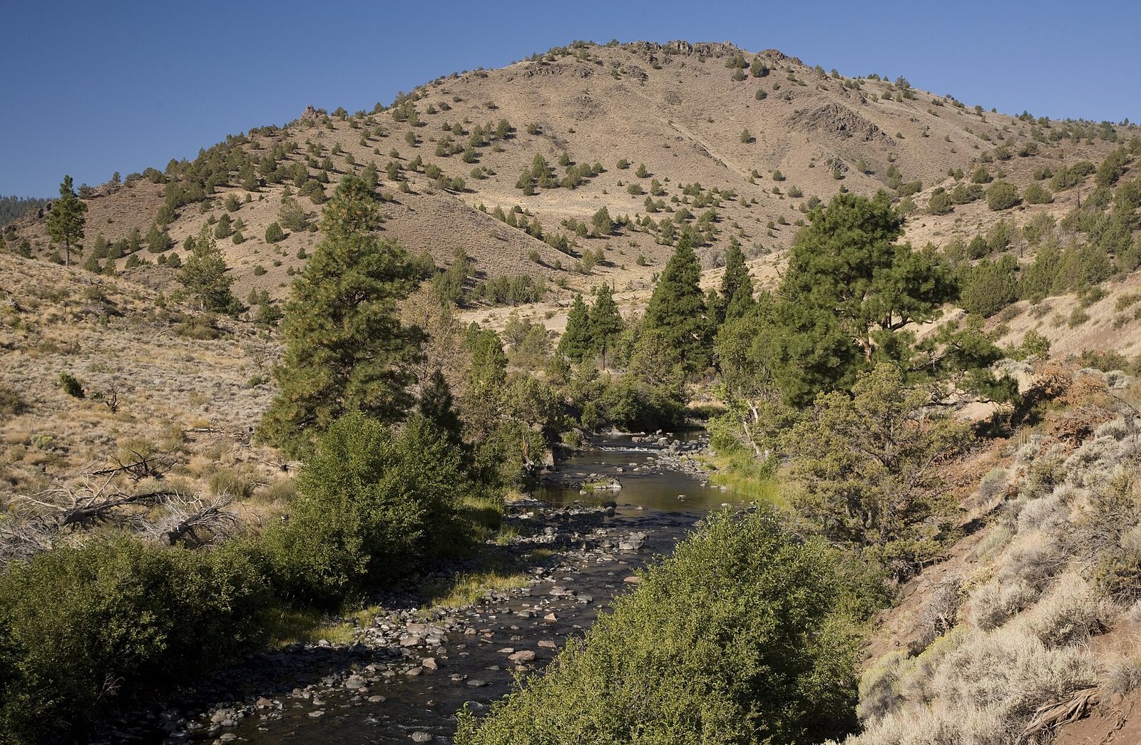 Marsters Spring
 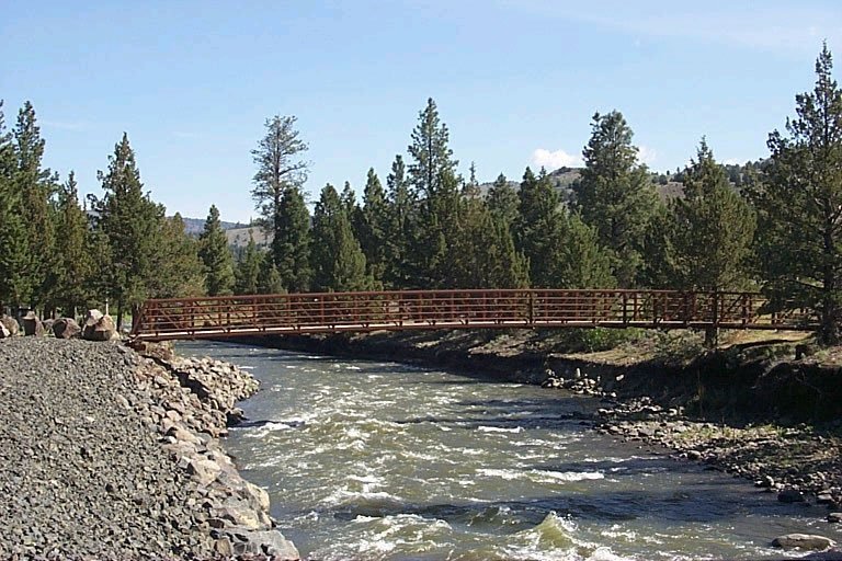 Chewaucan Crossing Campground / Trailhead Jones Crossing Campbell Lake Campground
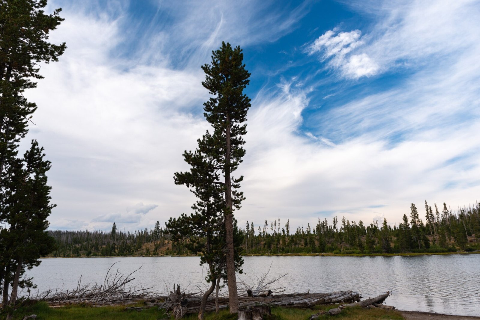 Deadhorse Lake Campground / Trailhead Dairy Point
 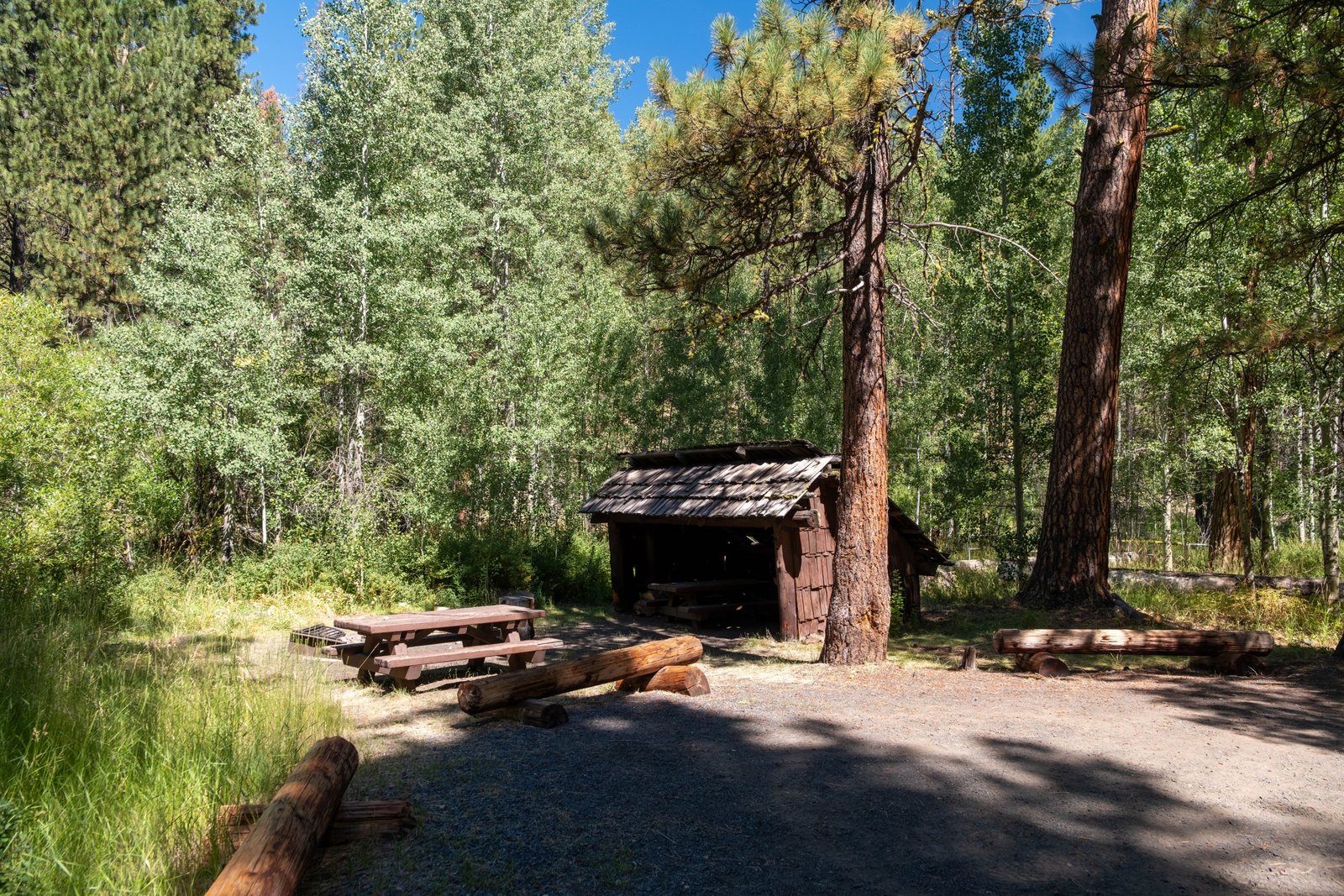 Happy Camp
 Camping near Paisley at a glance
- Public campgrounds
- 10 (10 National Forest)
- Getting a site
- 1 reservable and 9 first-come
- Cost
- 7 free; lowest posted fee at Campbell Lake Campground: "Single Site: $6 per night"
- Distance from Paisley
- 5.6 miles (Marsters Spring) to 18 miles (Sandhill Crossing) in a straight line; 5 within 15 miles
- Elevation
- 4,759 ft (Marsters Spring) to 7,200 ft (Deadhorse Lake Campground / Trailhead), 10 of 10 on record
- Season
- 9 seasonal with posted dates
- Campsites
- 83 across the 9 campgrounds that state a count
- Drinking water
- 6 of 10
Distances are straight-line miles from Paisley's point in the US Census Bureau Gazetteer (2025), not driving distances. Every other fact comes from each campground's own sourced record, linked from its page.
Reservable Marsters Spring - Agency
- National Forest
- Sites
- 10
- Season
- Not on record
- Fee
- Single Site: $6 per night
First-come Chewaucan Crossing Campground / Trailhead - Agency
- National Forest
- Sites
- 5
- Season
- May 15 to October 15
- Fee
- Free
- Agency
- National Forest
- Sites
- 8
- Season
- May 15 to October 15
- Fee
- Free
- Agency
- National Forest
- Sites
- 18
- Season
- May 15 to October 15
- Fee
- Single Site: $6 per night
First-come Deadhorse Lake Campground / Trailhead - Agency
- National Forest
- Sites
- 16
- Season
- May 15 to October 15
- Fee
- Single Site: $6 per night
- Agency
- National Forest
- Sites
- 5
- Season
- May 15 to October 15
- Fee
- Free
First-come Happy Camp - Agency
- National Forest
- Sites
- 9
- Season
- May 15 to October 15
- Fee
- Free
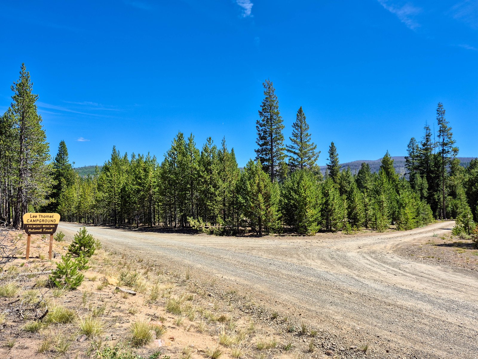 First-come Lee Thomas Campground
 - Agency
- National Forest
- Sites
- 7
- Season
- May 15 to October 15
- Fee
- Free
- Agency
- National Forest
- Sites
- Not on record
- Season
- May 15 to October 15
- Fee
- Free
- Agency
- National Forest
- Sites
- 5
- Season
- May 15 to October 15
- Fee
- Free
No campgrounds match.
More campgrounds within 30 miles of Paisley
- Corral Creek, 20 miles from Paisley in a straight line , National Forest , first-come (free); listed under camping near Bly.
- Vee Lake, 27 miles from Paisley in a straight line , National Forest , first-come (free); listed under camping near Lakeview.
- Horseglade, 28 miles from Paisley in a straight line , National Forest , first-come (free); listed under camping near Bly.
- Can Springs, 29 miles from Paisley in a straight line , National Forest , first-come (free); listed under camping near Lakeview.
- Cottonwood Recreation Area, 29 miles from Paisley in a straight line , National Forest , first-come (Single Site: $6 per night); listed under camping near Lakeview.
Things to do near Paisley
Public land and water within 30 miles of Paisley, the public land its campgrounds sit in, and landmarks at those campgrounds, nearest first.
- Fremont-Winema National Forest, all 10 campgrounds here sit inside this national forest, the nearest Marsters Spring at 5.6 miles from Paisley; publiclandsdb.com has its dispersed-camping rule, ranger offices, and boundary.
- Summer Lake Hot Springs, a hot spring whose mapped point is 5.7 miles from Paisley; soaking details on swimholesmap.com.
- Fremont National Recreation Trail #160, at Chewaucan Crossing Campground / Trailhead (6.1 miles from Paisley): The trailhead in the campground reaches the Fremont National Recreation Trail across a pedestrian bridge over the Chewaucan River, north to Yamsay Mountain or south to Cox Pass.
- Chewaucan River and Fremont National Recreation Trail, at Jones Crossing (6.6 miles from Paisley): Right on the Chewaucan River (rainbow and brook trout); Fremont National Recreation Trail #160 is reached at Chewaucan Crossing on the way in.
- Campbell Lake, at Campbell Lake Campground (14 miles from Paisley): A high mountain lake stocked with rainbow trout, with a boat ramp for non-motorized or electric-motor boats (5 mph limit) and the Lakes Trail System loop to Deadhorse Lake.
- Deadhorse Lake, at Deadhorse Lake Campground / Trailhead (15 miles from Paisley): A 31-acre high-mountain lake at 7,372 feet, stocked with rainbow trout, with a boat launch (non-motorized or electric motors, 5 mph) and access to the Lakes Trail System.
- CCC picnic shelters on Dairy Creek, at Happy Camp (16 miles from Paisley): Historic picnic shelters built by the Civilian Conservation Corps in the 1930s; Dairy Creek runs through the campground with rainbow trout fishing and horseshoe pits.
- North Fork Sprague River and Deadhorse Rim Trail, at Lee Thomas Campground (17 miles from Paisley): All seven sites are on the Wild and Scenic North Fork Sprague River; Lee Thomas Trailhead, a mile east, reaches Deadhorse Rim Trail #139.
- Ana River fishing, a fishing water whose mapped point is 18 miles from Paisley; stocking record and species on fishypedia.com.
- North Fork Sprague Wild and Scenic River, at Sandhill Crossing (18 miles from Paisley): Remote lodgepole-and-meadow campground at about 6,300 ft overlooking the North Fork of the Wild and Scenic Sprague River; a popular fall hunting camp.
Supplies and emergencies near Paisley
Nearest emergency room: Lake District Hospital, 700 S J St, Lakeview, OR, 37 miles from Paisley , (541) 947-2114. Next nearest: Sky Lakes Medical Center, 2865 Daggett Ave, Klamath Falls, OR, 70 miles, (541) 882-6311. Both report emergency services in the CMS Hospital General Information dataset (accessed 2026-09-26) . In an emergency, call 911.
- Groceries
-
- Paisley Mercantile Inc.
- Gas & Snacks
- Valley Falls Store
- Fuel
-
- Pacific Pride
- Chewaucan Garage
- Summer Lake Store
- RV dump station
-
- Oregon Outback RV Park
Not mapped in OpenStreetMap within 25 miles of Paisley: propane, potable water fill, pharmacy, laundromat, and ice. Stores, fuel, propane, dump stations, water fill, laundromats, and pharmacies are the nearest few mapped within 25 miles, straight-line, © OpenStreetMap contributors (data as of 2026-09-29; this extract under the ODbL). Hours are as mapped; call ahead.
Common questions
Where can I camp around Paisley, OR?
Is there free camping near Paisley, OR?
Where can I camp near Paisley with drinking water?
When is camping season near Paisley, OR?
Where is the nearest emergency room to Paisley, OR?
Every campground in the state: camping in Oregon ; by agency: National Forest campgrounds in Oregon ; by county: campgrounds in Lake .