
Camping near Cleveland, Utah
Camping near Cleveland, Utah includes 3 public campgrounds on record, 1 reservable and 2 first-come. All are run by the Bureau of Land Management. The nearest, Buckhorn Draw, is 14 miles from Cleveland in a straight line, and 1 of 3 is within 15 miles. Another 22 public campgrounds filed under nearby towns are within 30 miles of Cleveland.
noindex Fewer than 5 campgrounds here clear the indexable bar yet, so this page stays noindex.
Camping near Cleveland at a glance
- Public campgrounds
- 3 (3 BLM)
- Getting a site
- 1 reservable and 2 first-come
- Cost
- Lowest posted fee at Buckhorn Draw: "$15/night individual site; $50/night group site"
- Distance from Cleveland
- 14 miles (Buckhorn Draw) to 21 miles (San Rafael Swinging Bridge Campground) in a straight line; 1 within 15 miles
- Campsites
- 61 across the 3 campgrounds that state a count
Distances are straight-line miles from Cleveland's point in the US Census Bureau Gazetteer (2025), not driving distances. Every other fact comes from each campground's own sourced record, linked from its page.
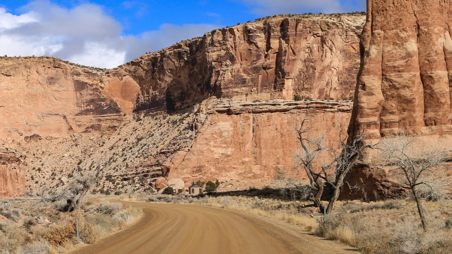 Reservable Buckhorn Draw
 - Agency
- BLM
- Sites
- 32
- Season
- Not on record
- Fee
- $15/night individual site; $50/night group site
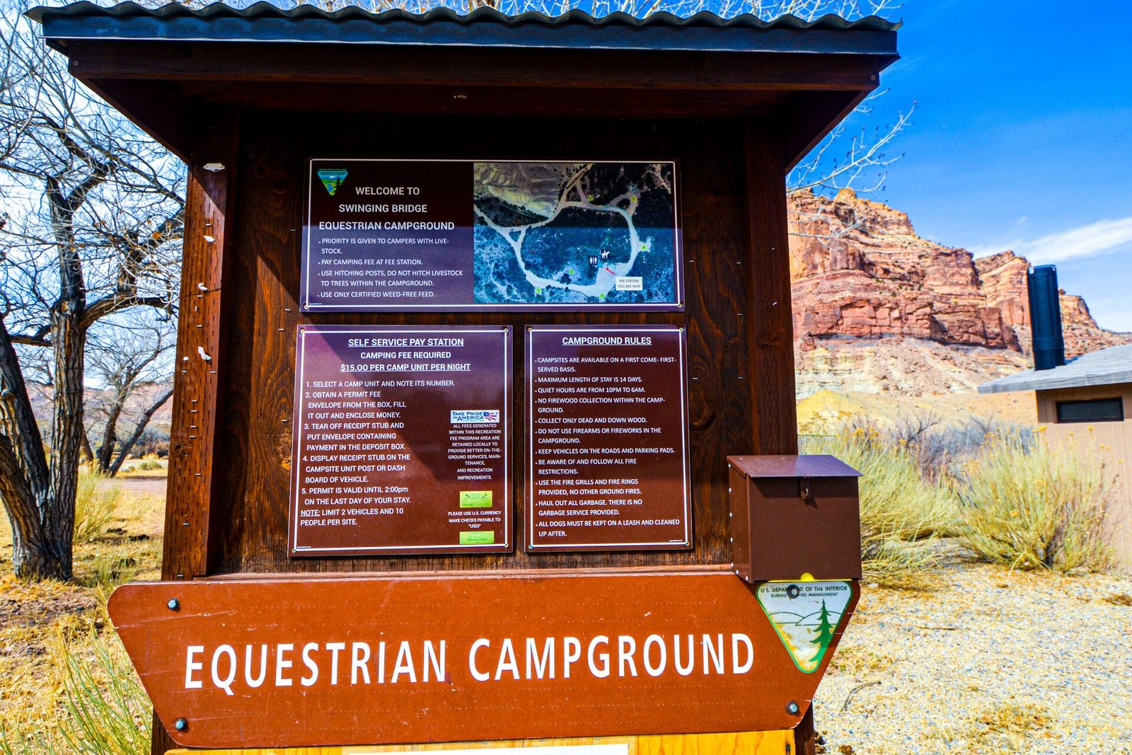 First-come Equestrian Campground
 - Agency
- BLM
- Sites
- 6
- Season
- Not on record
- Fee
- $15/night per site
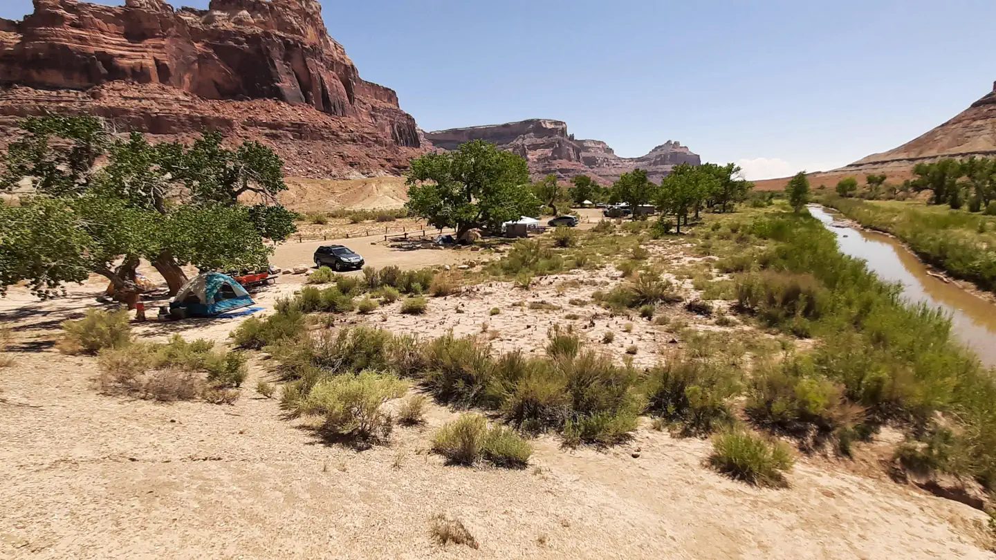 First-come San Rafael Swinging Bridge Campground
 - Agency
- BLM
- Sites
- 23
- Season
- Not on record
- Fee
- $15/night per site
More campgrounds within 30 miles of Cleveland
- Huntington State Park Campground, 4.6 miles from Cleveland in a straight line , State Park , reservable (Full hookup $33/night, water and electric $30); listed under camping near Huntington.
- New Joe's Campground, 14 miles from Cleveland in a straight line , BLM , first-come ($15 per night per individual site; 50% off with Senior or Golden Age pass); listed under camping near Orangeville.
- River Bend Campground, 16 miles from Cleveland in a straight line , National Forest , first-come ($5/night per vehicle); listed under camping near Huntington.
- Lower Little Bear Campground, 16 miles from Cleveland in a straight line , National Forest , first-come ($5/night per vehicle; group site $30 to $50/night); listed under camping near Huntington.
- Little Bear Group Campground, 17 miles from Cleveland in a straight line , National Forest , reservable (Group site A $50/night (50 people); group site B $30/night (30 people); both $80/night); listed under camping near Huntington.
- Cottonwood Canyon Campground, 18 miles from Cleveland in a straight line , BLM , first-come ($15 per night per individual site); listed under camping near Orangeville.
- Sids Mountain Wilderness - The Wedge, 18 miles from Cleveland in a straight line , BLM ; listed under camping near Castle Dale.
- Forks of Huntington Campground, 20 miles from Cleveland in a straight line , National Forest , reservable (Single Site: $10 per night); listed under camping near Huntington.
- Big Rock Group Campground, 20 miles from Cleveland in a straight line , National Forest , reservable ; listed under camping near Huntington.
- Old Folks Flat Group Campground, 21 miles from Cleveland in a straight line , National Forest , reservable ($10/night single site; $30 to $75/night group site); listed under camping near Huntington.
- Little Rock Campground, 21 miles from Cleveland in a straight line , National Forest , first-come ($5/night per vehicle); listed under camping near Huntington.
- Indian Creek Group Campground, 22 miles from Cleveland in a straight line , National Forest , reservable (Group sites $30/night (30 people), $40 (50 people), $50 (70 people); $3/vehicle when unreserved); listed under camping near Orangeville.
- The Bridges Campground, 22 miles from Cleveland in a straight line , National Forest , reservable (Single Site: $5 per night (1 vehicle included per site)); listed under camping near Huntington.
- Potters Pond Campground, 23 miles from Cleveland in a straight line , National Forest , reservable (Single Site: $10 per night); listed under camping near Huntington.
- Joes Valley Pavilion Group Campground, 23 miles from Cleveland in a straight line , National Forest , reservable ($50/night group site (100 people max)); listed under camping near Orangeville.
- The Chute Group Campground, 23 miles from Cleveland in a straight line , National Forest , reservable ($50/night group site (50 people max)); listed under camping near Huntington.
- Joes Valley Campground, 24 miles from Cleveland in a straight line , National Forest , reservable ($10/night single site; $18/night double site); listed under camping near Orangeville.
- Miller Flat Reservoir Campground, 24 miles from Cleveland in a straight line , National Forest , reservable (Single Site: $15 per night); listed under camping near Mount Pleasant.
- Millsite State Park Campground, 25 miles from Cleveland in a straight line , State Park , reservable (Electric and water (sites A, B, 1-10) $30/night, electric only (sites 11-20) $25; $15 per extra vehicle); listed under camping near Emery.
- Cleveland Reservoir, 26 miles from Cleveland in a straight line , National Forest , first-come ($5/night per vehicle (5 single and 2 double sites)); listed under camping near Fairview.
- Lake Canyon Rec Area, 26 miles from Cleveland in a straight line , National Forest , reservable ($30/night reservable double site; $60/night group site A (150 max); walk-in $15 double, $20 group); listed under camping near Huntington.
- Flat Canyon Campground, 30 miles from Cleveland in a straight line , National Forest , reservable (Single Site: $10 per night); listed under camping near Fairview.
Things to do near Cleveland
Public land and water within 30 miles of Cleveland, the public land its campgrounds sit in, and landmarks at those campgrounds, nearest first.
- Huntington North Reservoir fishing, a fishing water whose mapped point is 4.7 miles from Cleveland; stocking record and species on fishypedia.com.
- Huntington State Park, a state park whose mapped point is 4.9 miles from Cleveland; its hours, entrance fee, and boundary on publiclandsdb.com.
- Jurassic National Monument, a BLM unit whose mapped point is 8.6 miles from Cleveland; its camping rule, field office, and boundary on publiclandsdb.com.
- Buckhorn Draw canyon, at Buckhorn Draw (14 miles from Cleveland): Sites line nine miles of road through the San Rafael River's longest tributary canyon, between Sids Mountain and Mexican Mountain wilderness areas, passing the Buckhorn Pictograph Panel.
- Sid's Mountain Wilderness, a wilderness area whose mapped point is 21 miles from Cleveland; its permit and camping rules and boundary on publiclandsdb.com.
- Horse corrals, at Equestrian Campground (21 miles from Cleveland): Built by equestrians for equestrians: each of the six sites has a corral, and the sites surround a central holding pen with three stalls.
- San Rafael Swinging Bridge, at San Rafael Swinging Bridge Campground (21 miles from Cleveland): The 160-ft suspension bridge built by the Civilian Conservation Corps in 1937, Utah's oldest intact one, spans the San Rafael River beside the campground.
- Joes Valley Reservoir fishing, a fishing water whose mapped point is 23 miles from Cleveland; stocking record and species on fishypedia.com.
- Miller Flat Reservoir fishing, a fishing water whose mapped point is 25 miles from Cleveland; stocking record and species on fishypedia.com.
- Mexican Mountain Wilderness, a wilderness area whose mapped point is 26 miles from Cleveland; its permit and camping rules and boundary on publiclandsdb.com.
Supplies and emergencies near Cleveland
Nearest emergency room: Castleview Hospital, 300 Hospital Dr, Price, UT, 18 miles from Cleveland , (435) 637-4800. Next nearest: Intermountain Health Sanpete Valley Hospital, 1100 S Medical Dr, Mount Pleasant, UT, 35 miles, (435) 462-4123. Both report emergency services in the CMS Hospital General Information dataset (accessed 2026-09-26) . In an emergency, call 911.
- Groceries
-
- Stewarts Grocery Store
- Maverick Adventure's First Stop
- Maverik
- Fuel
-
- Sinclair
- Maverik
- Harts Gas And Food
- RV dump station
-
- Blue Cut RV Park
- Pharmacy
-
- Southeastern Utah District Health Department / Boyds Family Pharmacy
- Walmart Pharmacy
Not mapped in OpenStreetMap within 25 miles of Cleveland: propane, potable water fill, laundromat, and ice. Stores, fuel, propane, dump stations, water fill, laundromats, and pharmacies are the nearest few mapped within 25 miles, straight-line, © OpenStreetMap contributors (data as of 2026-09-29; this extract under the ODbL). Hours are as mapped; call ahead.
Common questions
Where can I camp around Cleveland, UT?
Is there free camping near Cleveland, UT?
Where is the nearest emergency room to Cleveland, UT?
Every campground in the state: camping in Utah ; by agency: BLM campgrounds in Utah .